Vermillion Cliffs National Monument is a really remote area which straddles the Utah/Arizona border about midway between Page, AZ and Kanab, UT, about 40 miles from the nearest food, drink, and fuel. Inside the monument there is no visitor center, no flush toilets, no running water, no cell service, and no nearby help if you get yourself into trouble. So if you decide to visit, go prepared. “Prepared” includes a GPS that doesn’t require a cell tower and the skills to use it correctly, the ability to navigate in a trailless environment, knowledge of how to safely hike in a dessert environment (food / water needs and the effects of heat), and a high clearance 4WD vehicle if you venture beyond Buckskin Gulch and Wirepass Trailheads. That includes Cottonwood Cove, which is where we went for this post.
To reach Cottonwood Cove we first traveled about 40 miles on US 89 from Kanab to House Valley Rock Road. HVR Rd is a gravel, rock, and severely rutted clay road that goes north to south along the west side of the monument. We followed it for a little more than 20 miles and 1.5 hours…slow going. Then we drove about 15 miles on mostly unmarked roads, with many of them not on the only paper map we had, through mostly deep (10-12 inches) loose sand. When the road wasn’t deep sand it was partially exposed boulders and rock fins, which is very bouncy with our truck’s stiff suspension, even at 5 mph. We spent a grand total of about 4 hours driving before we arrived at the Cottonwood Cove Trailhead. At this point we were thinking “this better be beyond awesome”. On the way back to our campground we followed HVR Rd south to US 89A which saved 12 miles of dirt road driving and is a faster route.
Cottonwood Cove is part of the South Coyote Buttes section of the monument. There is also a North Coyote Buttes which includes ‘The Wave’ made famous by Microsoft when it was used as one of their screensavers. Since Microsoft publicized ‘The Wave’, entrance to both the North and South Coyote Butte areas requires a permit. The number of people each day is limited to 20 for each area in order to protect them from overuse. A permit is either obtained via an online lottery or an in person lottery. Ten permits for each area are allocated for each lottery. Over 200,000 people apply for a permit each year. We didn’t know we would be here in time to apply online so we got our permit via the in person lottery (which was cancelled due to the pandemic then reinstated for the South section only to a calendar sign-up first come first serve system). If you get a permit, but aren’t comfortable with the driving or back country navigation there are multiple guide services in the area that will drive you there and show you around.
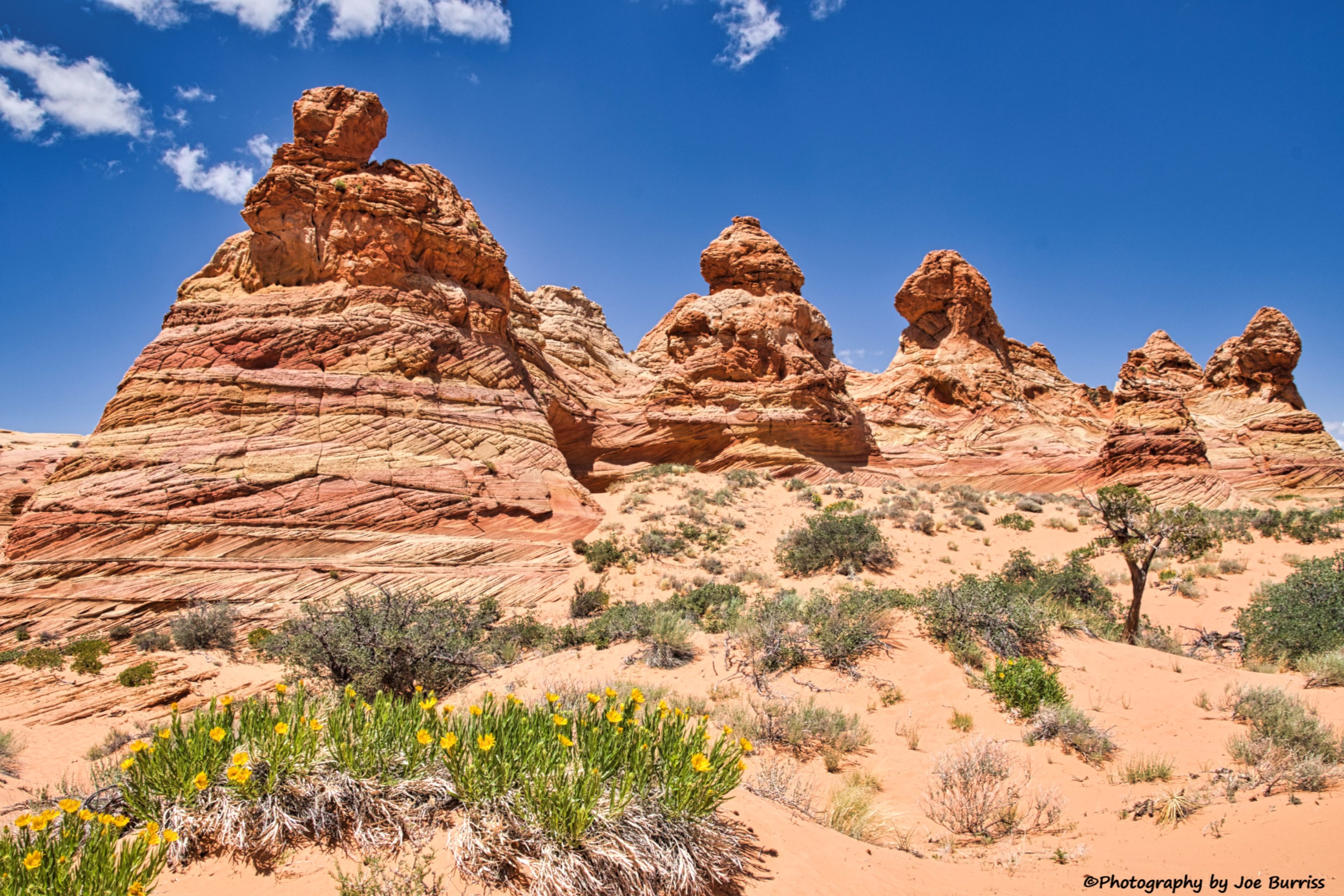
The first part of the hike is about 3/4 of a mile up a sand dune to the base of a massive rock monolith. Now the trail ends and the fun begins. Joe had stored waypoints on his GPS of the named rock formations in the area and we navigated to the closest ones. This required climbing the monolith which in places was steeper than 30 degrees.

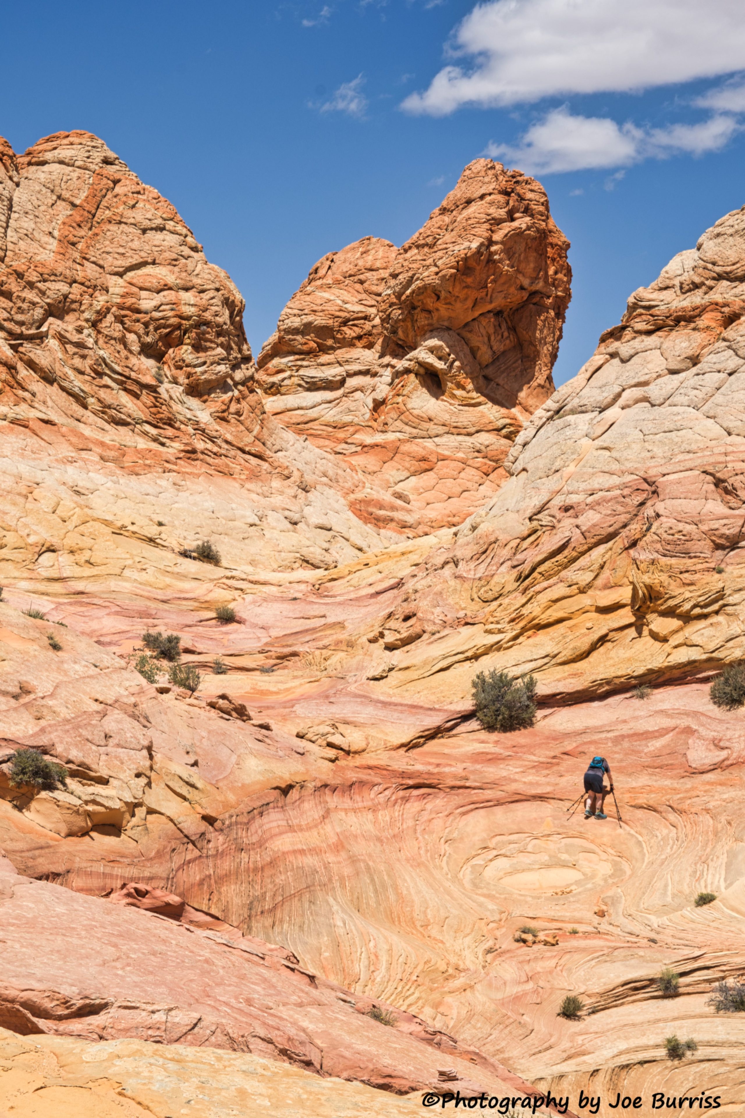

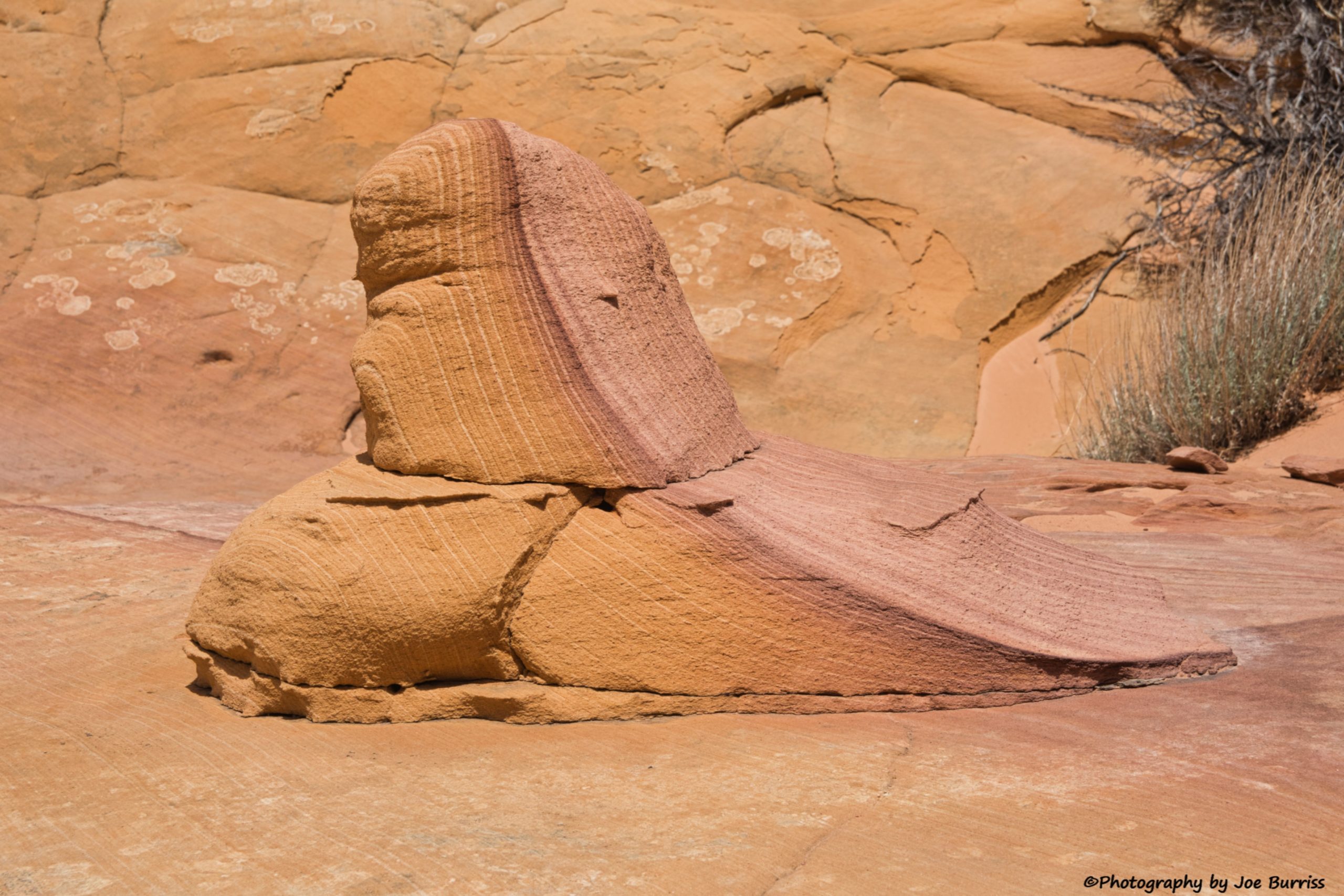
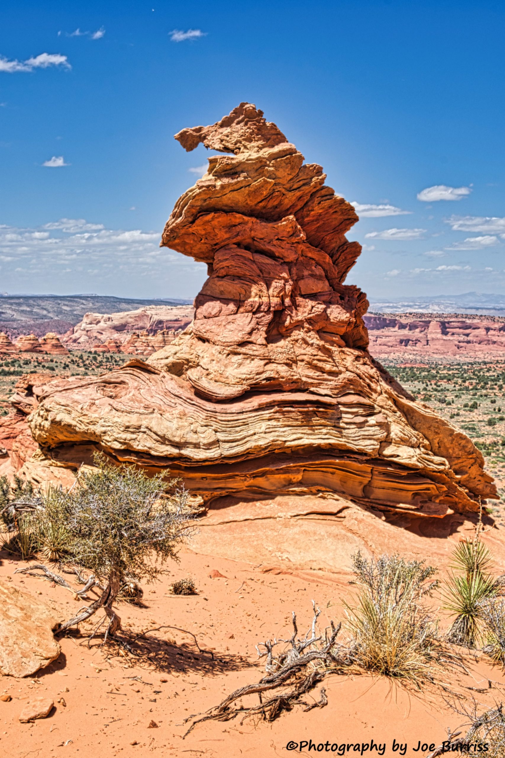
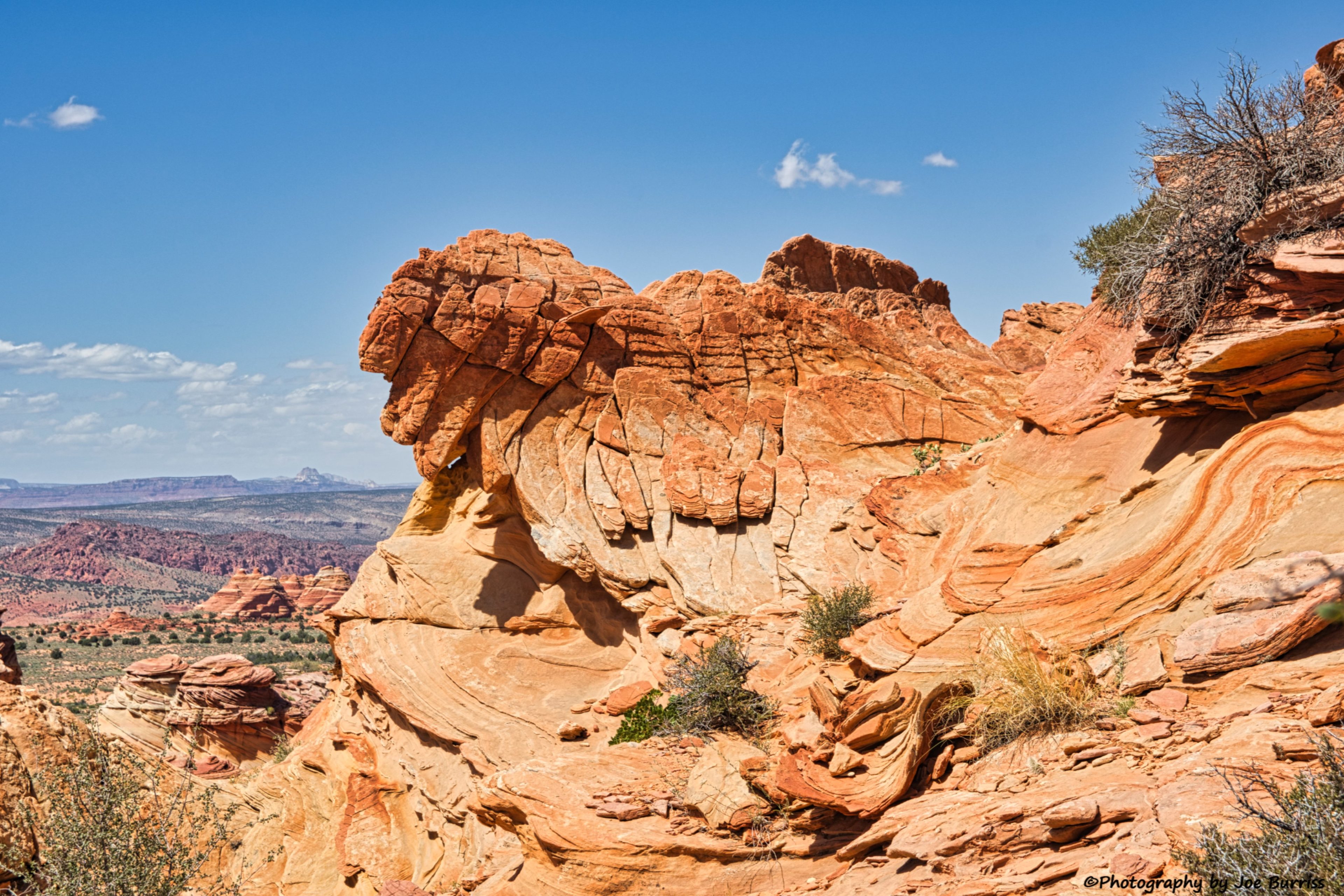
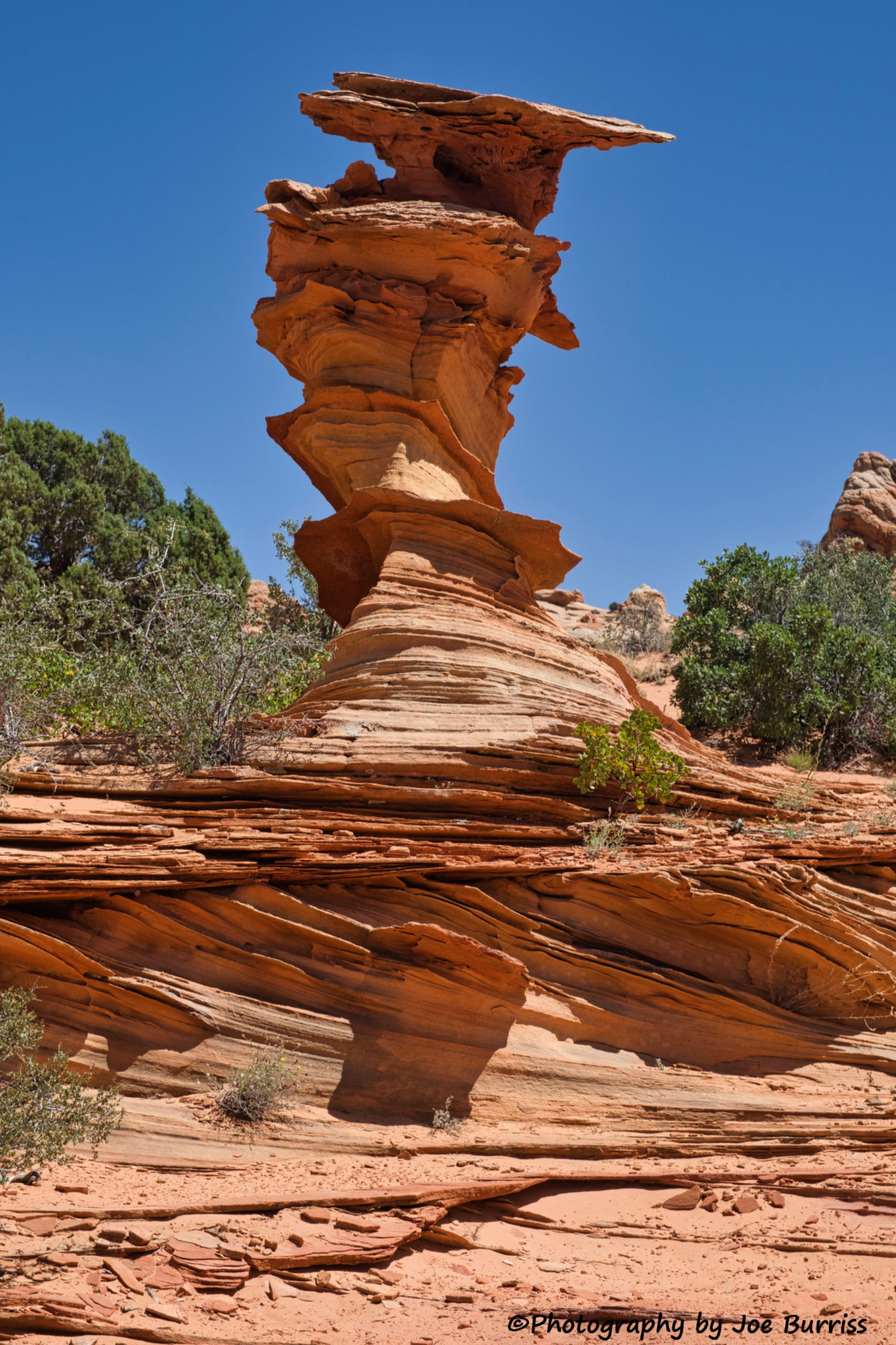
Once on top of the monolith we did a combination of wandering about in awe, resting, drinking, and snacking a bit, and using our waypoints to find the named formations. Then we selected a route out and down from the monolith which was more sand and less steep than the route we took into it.
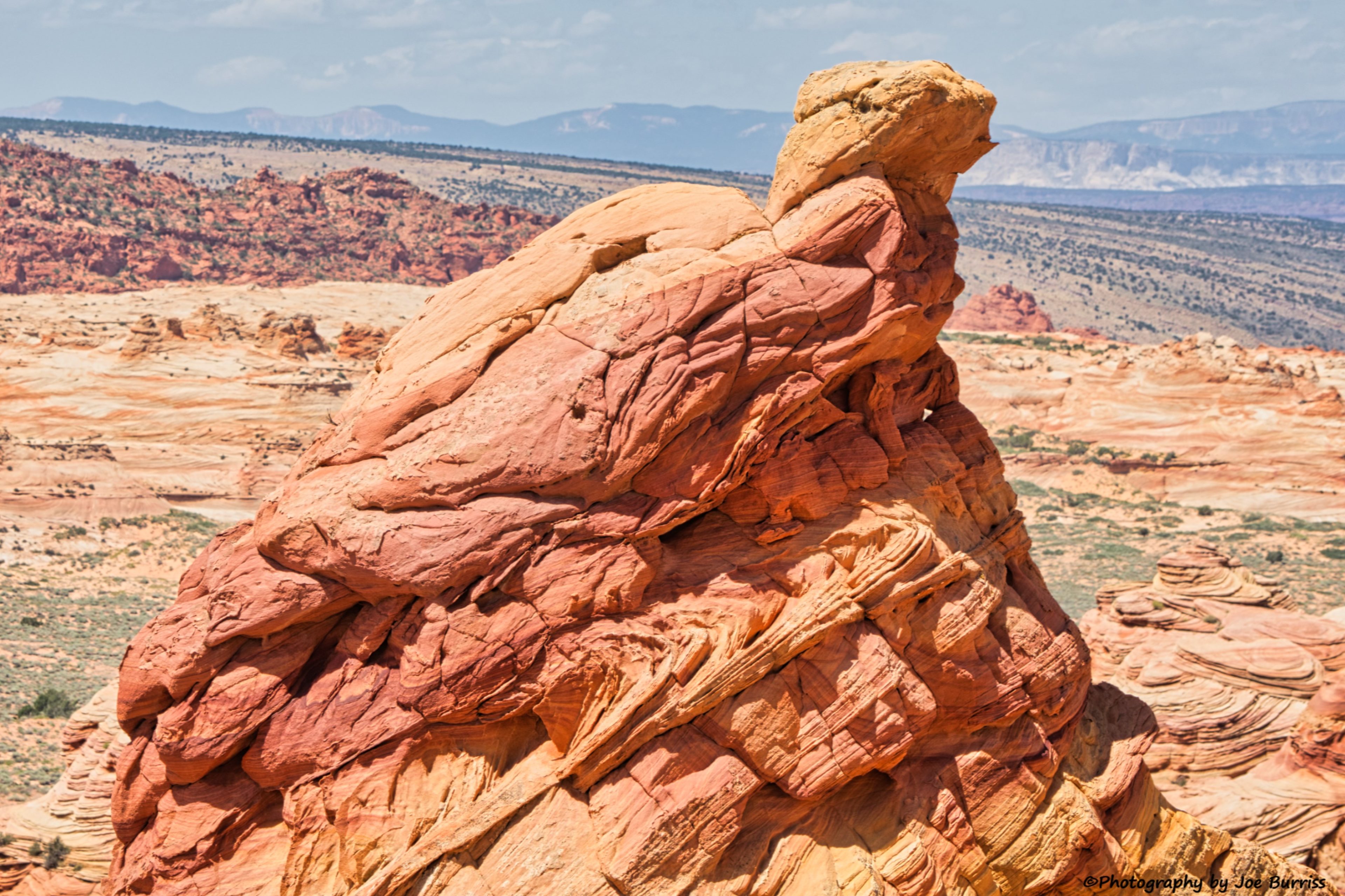
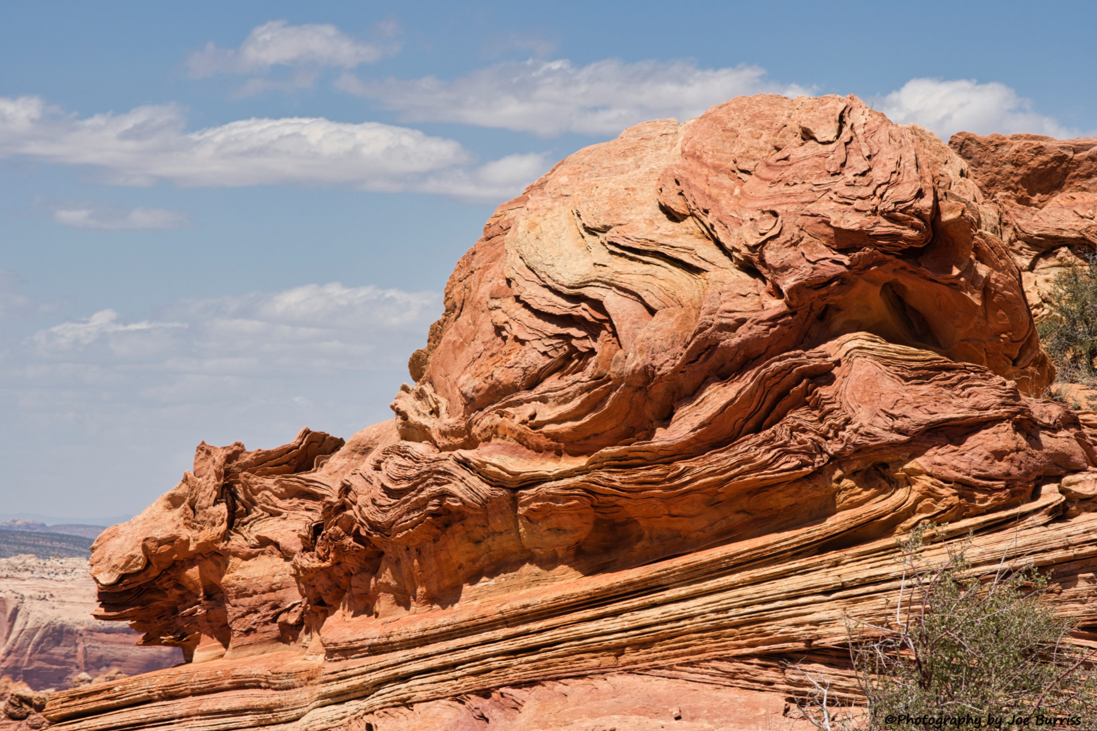

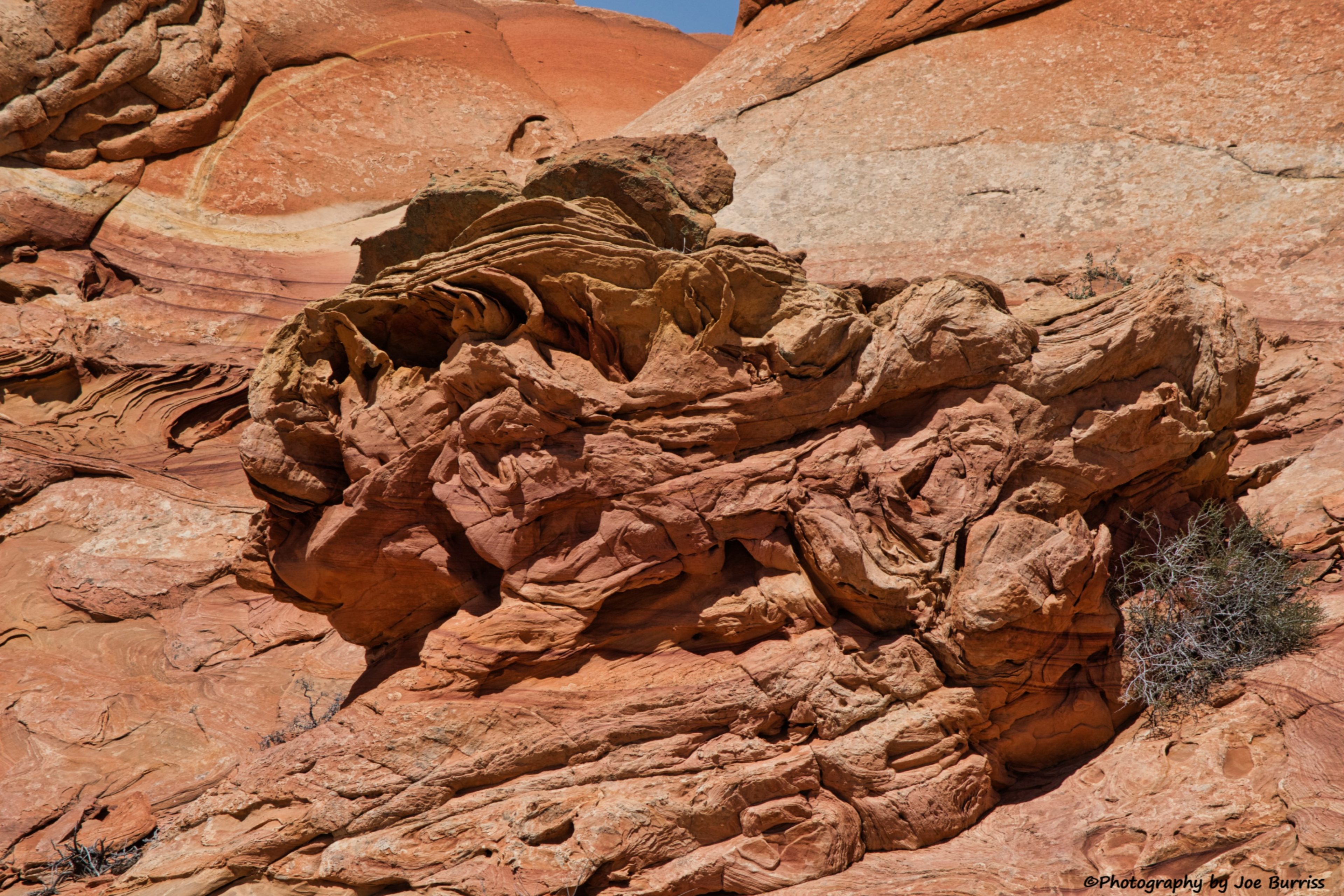
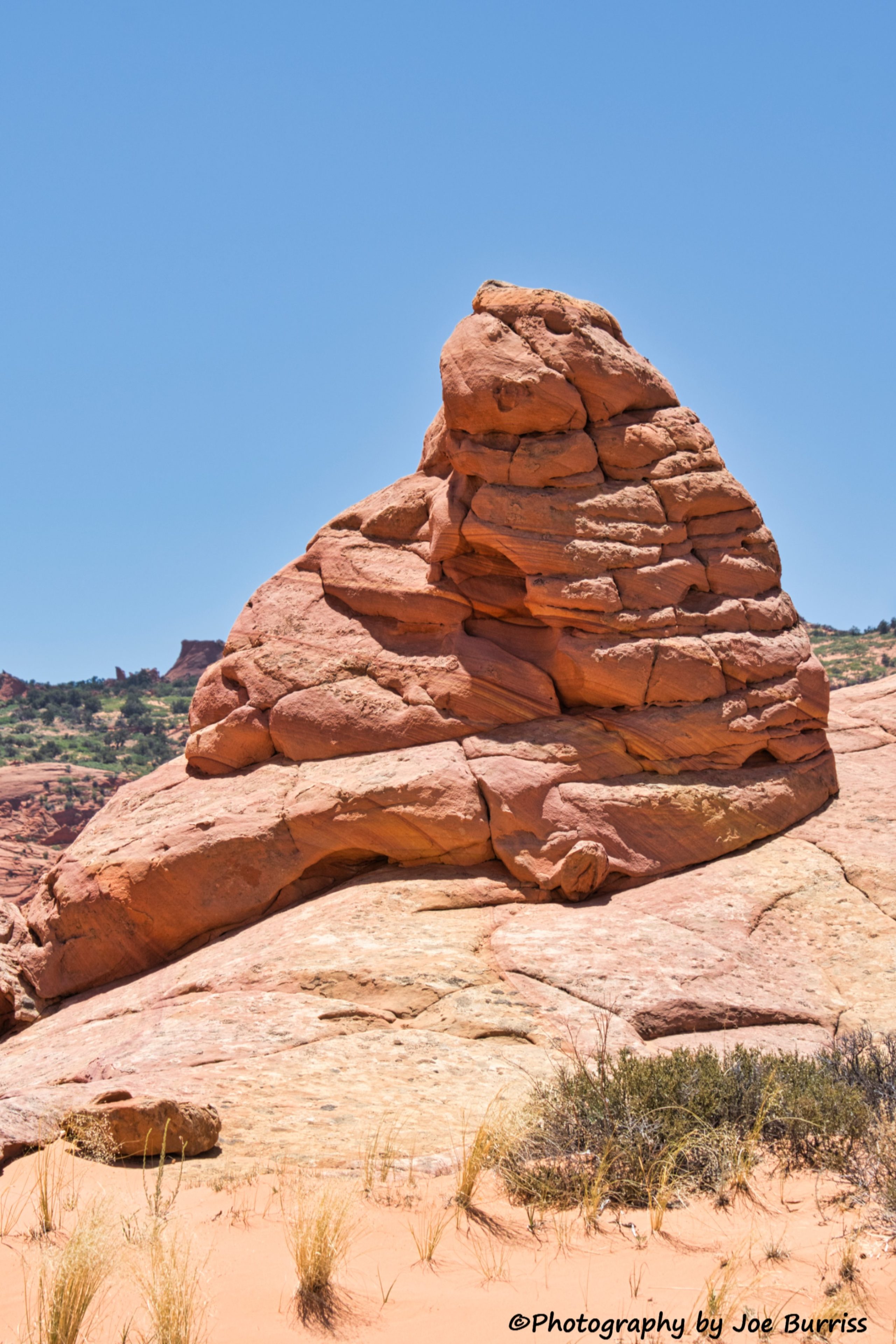

At the end of the day the beauty and awesomeness of mother nature’s rock art made the effort to get there worthwhile and we recommend this experience to those who are able to hike rock and sand dunes and are willing to pay a guide service. In hindsight, Joe would not have driven this route. He got advice from both the BLM and a professional photographer and was encouraged to drive us out there. Having now done the drive, there is too much risk of getting stuck and spending the night in the desert. We only saw six other people and two vehicles after we left House Valley Rock Road. Joe is paying to join an all-day tour to see White Pockets which is several miles further into the sand and desert than we went.